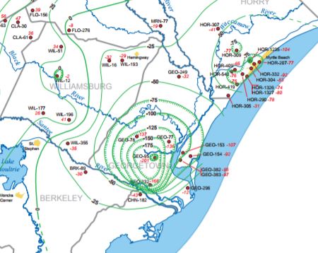
The Groundwater Program produces potentiometric maps to evaluate water-level conditions throughout the state's major aquifers.
Overview
The potentiometric surface of an aquifer is defined by the elevations at which water stands in tightly cased wells completed in the aquifer. Since the 1980s, the Hydrology Section, in collaboration with the U.S. Geological Survey, SCDES, and the U.S. Department of Energy at the Savannah River Site, has prepared numerous potentiometric maps of the major Coastal Plain aquifers in order to assess changes in groundwater storage, determine regional ground-water flow directions and hydraulic gradients, calibrate groundwater models, and identify areas experiencing excessive groundwater pumping.
Water-level data used to construct these maps are collected from hundreds of wells, including numerous monitoring wells and a variety of public-supply, industrial, agricultural, and domestic wells. Typically, the potentiometric surface of one of three major Coastal Plain aquifers is mapped each year, in November and December.
For more information about the Hydrology Section’s potentiometric mapping program, contact Andrew Wachob at andy.wachob@des.sc.gov or by phone at (803)898-0324.

