BCM Gears up for Annual Beachfront Structural Inventory
Thursday, Mar 5, 2026
Earlier this month, staff at the Bureau of Coastal Management participated in training to prepare for BCM’s annual Beachfront Structural Inventory field work. This field effort occurs every spring and assists BCM in maintaining an inventory of habitable structures, pools and erosion control structures located within the state’s beachfront jurisdiction. The Beachfront Structural Inventory is part of SCDES BCM’s Emergency Operations Program.
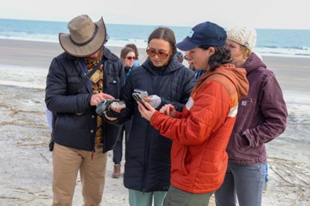
Photo Credit: Haley Schanne, SCDES BCM. Critical Area Permitting Project Manager Grace Hall reviews the Esri Survey123 app during Beachfront Structural Inventory Training, Feb. 2026.
After a disaster, such as a significant storm event or period of significant erosion along the ocean shoreline, inventory data is used as a baseline to conduct damage assessment of beachfront structures. The inventory effort also provides SCDES BCM with an annual opportunity to visit the majority of the state’s beachfront and note any observed changes to structures that may have occurred since the previous inventory. Observed changes are shared with permitting staff in an effort to ensure they meet beachfront authorization requirements.
Photo Credit: Haley Schanne, SCDES BCM From left: Ethan Hillman (Critical Area Permitting Project Manager), Maddie Rich (Coastal Zone Consistency Project Manager), and Sara Barbagallo (Coastal Zone Consistency Project Manager), utilize tools and equipment to conduct structural inventory training, Feb 2026.
During training, staff brushed up on BCM’s role in emergency operations, as well as refamiliarized themselves with the various tools and equipment used in completing the Beachfront Structural Inventory. These tools include GIS parcel-level maps of beachfront properties, sophisticated Global Navigation Satellite System (GNSS) devices and agency cell phones for capturing photos.
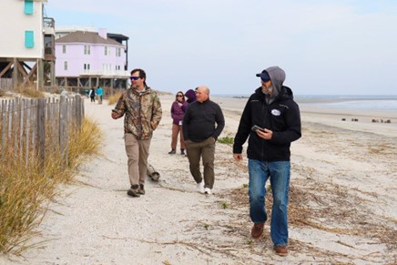
Photo Credit: Haley Schanne, SCDES BCM From left: Joe Young (Critical Area Permitting Project Manager), and Brad Jaynes (Critical Area Line Manager, Team Lead) participate in beachfront structural inventory training, Feb 2026.
Residents along South Carolina’s beaches may notice SCDES BCM employees completing field work along the beachfront over the next few months, including taking photos and crossing sand dunes. If you have any questions, feel free to ask our staff in the field, or contact the Bureau of Coastal Management at (843) 953-0200. To learn more about the State’s Beachfront Jurisdiction, please visit des.sc.gov/beachfront.