February 2 is World Wetlands Day; SPOTLIGHT: Cathedral Bay Heritage Preserve
Monday, Feb 1, 2021
February 2 is World Wetlands Day, and it’s a great occasion to learn about South Carolina’s beautiful wetlands and their importance. DHEC works with other agencies, such as the U.S. Army Corps of Engineers and the S.C. Department of Natural Resources (SCDNR), to help protect wetlands across our state.
Wetlands are vegetated aquatic ecosystems that include areas such as Carolina bays, marshes, and swamps. There are approximately 4.1 million acres of wetlands in South Carolina, according to the U.S. Fish and Wildlife Service.
Wetlands are also home to reptile and amphibian populations as well as rare plants. In addition to being a haven for wildlife, the watery environments provide safety and health benefits to communities in the state by reducing flooding as well as cleaning and replenishing water supplies.
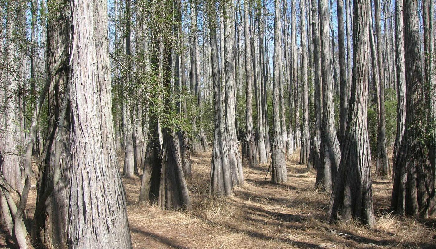
This year, theEnvironmental Affairs Team would like to highlight Cathedral Bay Heritage Preserve.Also known as Chitty Bay or Chitty Pond, it is almost a pure stand of Pond Cypress.
The trees have wide buttressed bases, an adaptation to saturated and flooded soils. Looking off into the distance from within the bay, these majestic trees appear closer together as they recede into the distance, bringing to mind the view one might have standing inside a towering cathedral among the columns supporting its roof and within its buttressed walls.
Managed by the SCDNR through the Heritage Trust Program, this property in Bamberg County is a type of wetland known as a Carolina Bay. These wetlands get their name because the vast majority of these occur in North and South Carolina and due to their abundance of bay trees.
Besides serving as a refuge for many rare plants and wildlife, Carolina Bays share distinctive features, including an elliptical or oval shape and parallel orientation with one another along a northwest to southeast axis. There has been much debate about the origin of these features over the years, but recent work suggests they are relict thermokarst lakes, which develop by thawing of frozen ground, with subsequent modification by wind and waves.