Line Review Process Overview
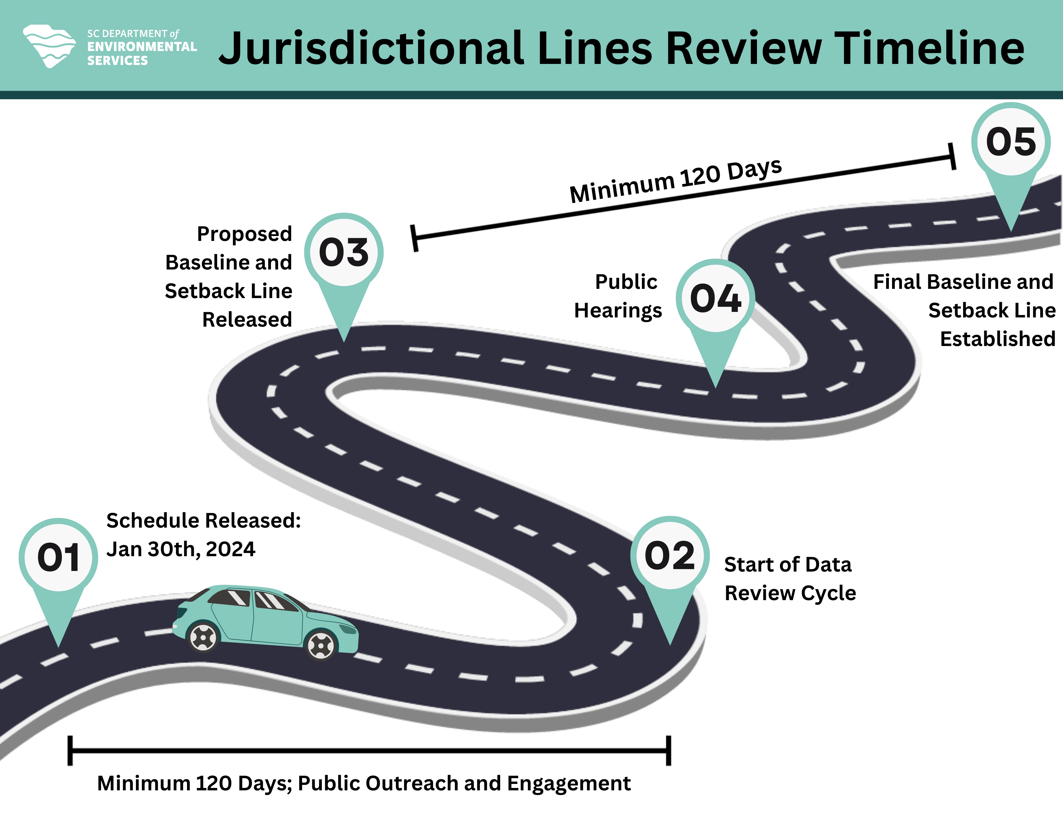
South Carolina law requires SCDES BCM to establish and review the position of these beachfront jurisdictional lines every 7 to 10 years. The average annual erosion rate, also known as the long-term erosion rate, for all oceanfront land that is developed or potentially could be developed is also reviewed during this time frame.
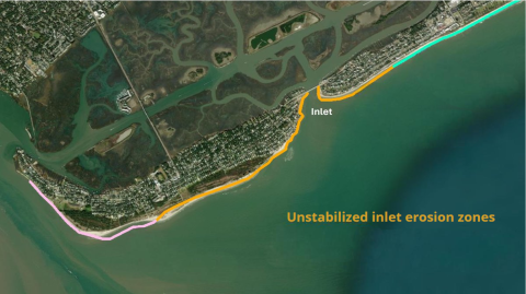
Using historical and present-day shoreline and beach profile information, SCDES BCM designates a baseline and setback line along the coast. The setback line's distance from the baseline is determined by calculating the long-term annual erosion rate in that particular area. The minimum setback distance is 20 feet.
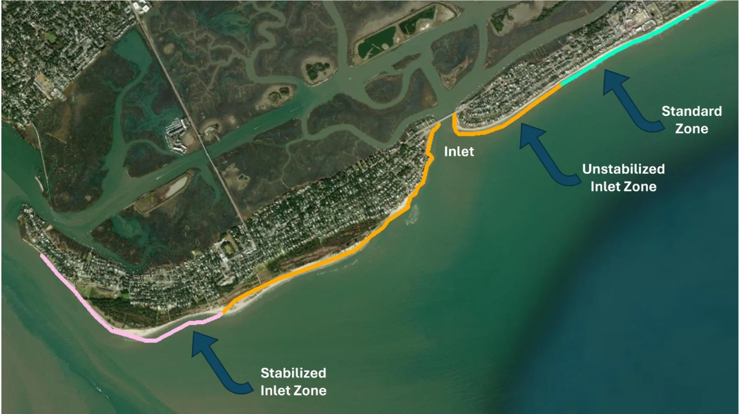
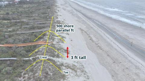
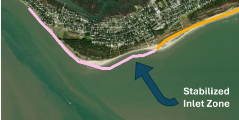 of the primary oceanfront sand dune at a distance equal to thirty percent of the measured distance from the primary oceanfront sand dune to the current line of stable vegetation. If there is no primary oceanfront sand dune, then the baseline must be established at whichever is further landward of the following: the baseline established during the 2016-2018 review cycle or the landward edge of the active beach. The Department utilizes the best available scientific data including both field and remotely sensed data to identify and establish the location of primary oceanfront sand dune. Remotely sensed data includes LiDAR and aerial imagery. Field data includes beach topographic and bathymetric profiles, and dune measurements, which are used in conjunction with remotely sensed data.