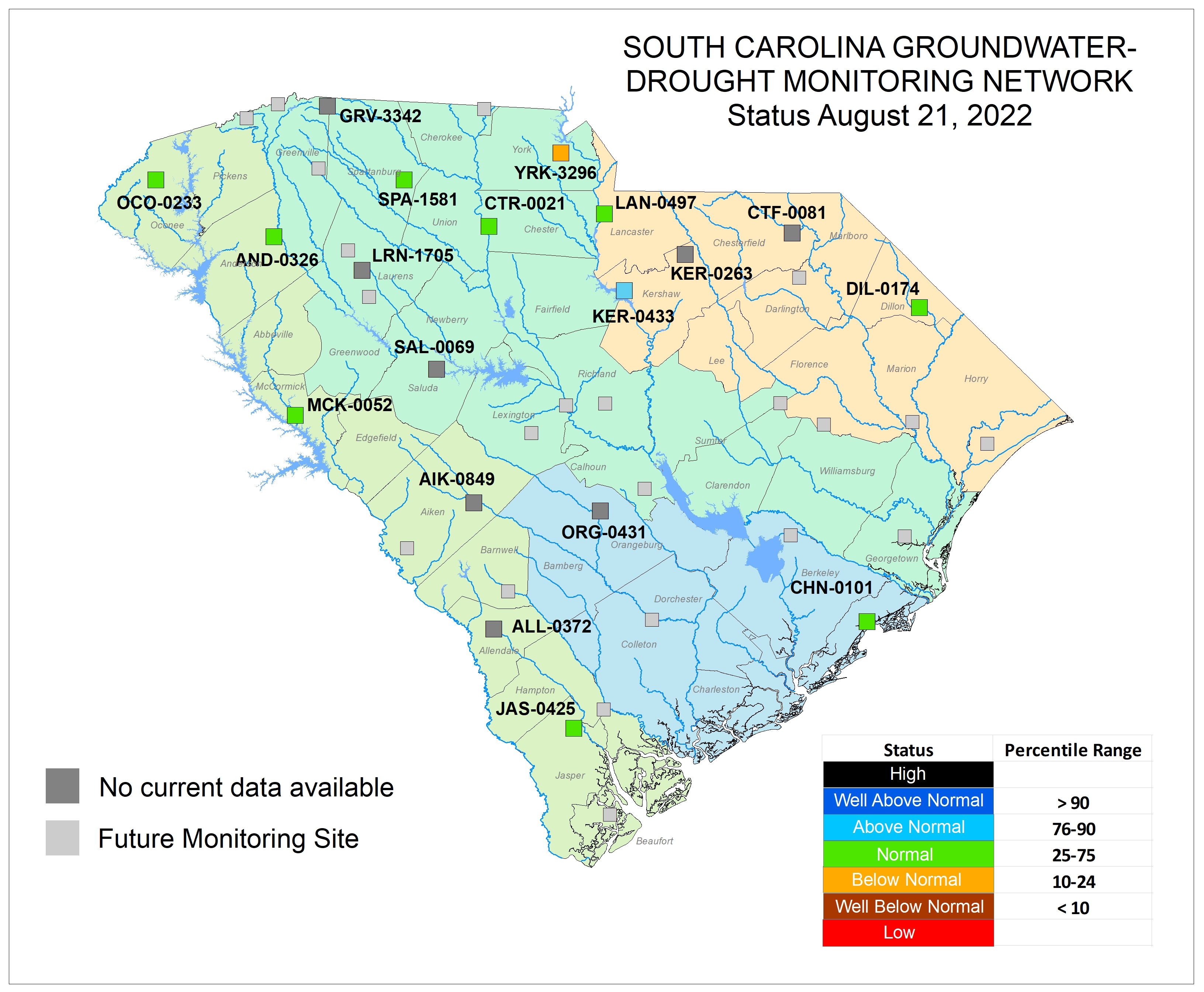
The Groundwater Program maintains a groundwater level monitoring network of more than 180 wells.
Overview
SCDES maintains a groundwater-level monitoring network of more than 180 wells in the State. Most of these wells are equipped with automatic data recorders that record water levels on an hourly basis, while the remaining wells are measured manually four to six times per year. Most wells have been measured since the mid-to-late 1990s, although a number of wells have been monitored longer, with one dating back to 1955. SCDES groundwater data can be viewed and downloaded here.
The network includes 33 cluster sites where two or more monitoring wells have been installed at varying depths in separate aquifers. Most wells are located within the Coastal Plain province, with only 15 wells located in the Piedmont and Blue Ridge physiographic provinces. A subset of the wells, the Groundwater Drought Monitoring Network, is equipped with telemetry systems for real-time data collection, and these wells are used for drought monitoring purposes. In some wells along the coast, salinity is also measured to better understand and monitor saltwater intrusion into the aquifers near the ocean.
Water-level data are used for the following purposes:
- Identifying short- and long-term changes in groundwater levels and aquifer storage caused by changes in pumping, recharge rates, and climatic conditions
- Calibrating groundwater flow models
- Producing potentiometric maps
- Determining regional hydraulic gradients and groundwater flow directions in the major aquifers
- Aquifer assessments
- Groundwater management and planning
- Drought monitoring
More information about SCDES’s groundwater-level monitoring network can be found in the South Carolina SCDES Groundwater Monitoring Network Status Report or by contacting Josh Williams (josh.williams@des.sc.gov).
In addition to the SCDES groundwater network, the USGS maintains a groundwater-level network of 20 wells in South Carolina. Water level data from those wells can be found here.
View and Download Groundwater Data
SCDES Groundwater Monitoring Network Map
Groundwater Drought Monitoring Network

Selected Groundwater Level Data Reports
- Groundwater Levels in South Carolina, 2011–2018
- SCDNR Groundwater Monitoring Network map (PDF)
- South Carolina DNR Groundwater Monitoring Network Status Report - July 2009 through June 2014 (PDF)
- Ground-Water Levels in South Carolina 2006-2010 (PDF)
- Water Resources Data for South Carolina, 2000-2005
- Water Resources Data for South Carolina, 2000-2001
- Ground-Water Levels in South Carolina - A Compilation of Historical Water-Level Data

